 |
 |
 |
| Westermanns Maps: |
 |
 |
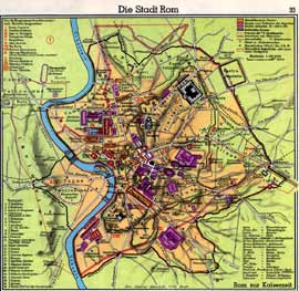
| The City of Rome Westermanns, Atlas zur Weltgeschichte, pg.33 Download Largest Size Image, Width 1750 |
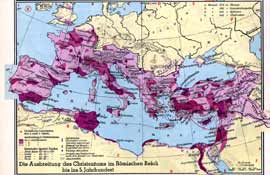
The Spread of Christianity in the Roman Empire (5th C) Westermanns, Atlas zur Weltgeschichte, pg. 44 Download Largest Size Image, Width 1750 |
 |
 |
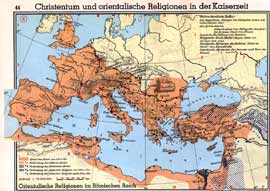
| Christian and Eastern Religions During the Roman Empire Westermanns, Atlas zur Weltgeschichte, pg. 44 Download Largest Size Image, Width 1750 |
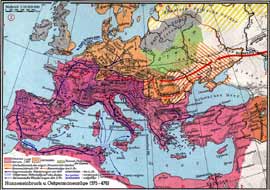
The Movement of the Goths, 375-476 Westermanns, Atlas zur Weltgeschichte, pg. 48 Download Largest Size Image, Width 1750 |
 |
 |
| The Kingdom of Charlemagne Westermanns, Atlas zur Weltgeschichte, pg. 54-55 Download Largest Size Image, Width 1750 |
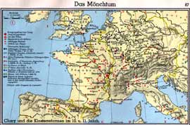
Monastic Sites in the 10th - 11th Centuries Westermanns, Atlas zur Weltgeschichte, pg. 87 Download Largest Size Image, Width 1750 |
 |
 |
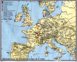
| Monastic Sites in the 12th Centuries Westermanns, Atlas zur Weltgeschichte, pg. 87 Download Largest Size Image, Width 1750 |
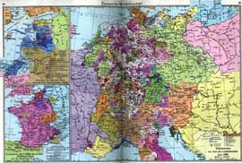
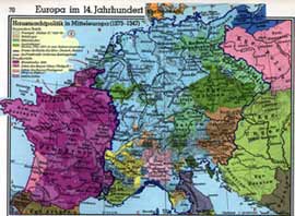
Europe in the 14th Century Westermanns, Atlas zur Weltgeschichte, pg. 68-69 Download Largest Size Image, Width 1750 |
 |
 |
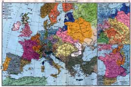
| Europe in the 15th Century Westermanns, Atlas zur Weltgeschichte, pg. 92-93 Download Largest Size Image, Width 1750 |
Europe in the 14th Century, Political Map of Western Europe Westermanns, Atlas zur Weltgeschichte, pg. 70 Download Largest Size Image, Width 1750 |
 |
|
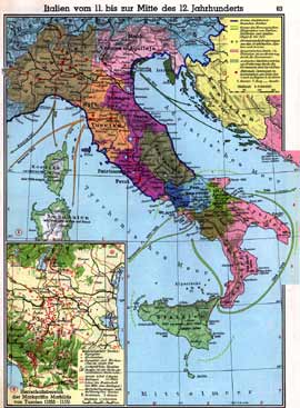
| Italy from 11th - 12th Century Westermanns, Atlas zur Weltgeschichte, pg. 63 Download Largest Size Image, Width 1750 |
|