Samarobriva: Roman Amiens (image from jeanclaudegolvin.com)
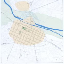
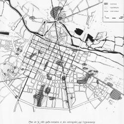
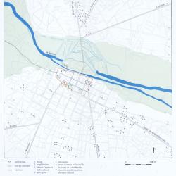
The earliest part of the Roman city, from the last decades BC, is contiguous with the river: it can be recognized by the street plan with rectangular insulae (islands) of 320 by 385 feet. In the later first century AD a massive expansion took place, marked by square insulae of 550 feet and magnificent public buildings including a forum and amphitheater. Population around 15,000.
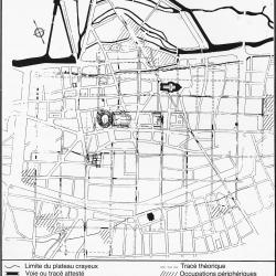
By the end of the third century this population had diminished by one half and new walls enclosed a much reduced urban space.
Note the important road, the Via Agrippa, running diagonally across the street grid. This was the main artery between the important Roman city of Lyon and the British Isles.